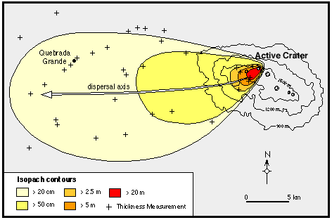
Isopachs use contour lines to map variations in different stratigraphic variables. These variables are dictated by the map uses, which include oil and coal prospecting. This map is the Isopach of the Rio Blanco Tephra Deposit.
http://www.geo.utexas.edu/faculty/barker/kempter/rbtephra.gif
No comments:
Post a Comment